1:250,000 USGS Topographic Map
Lawrence, KS 1:250,000
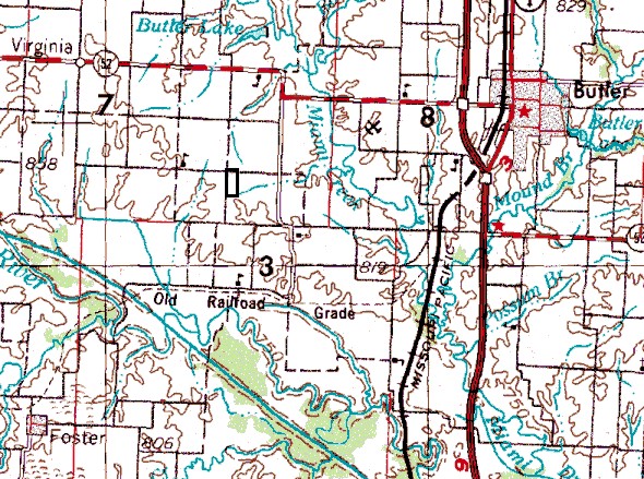
The rectangle deliniates the boundaries of the Toothman farm.
©2000 Chris Tabor
All rights reserved.